 Air survey photography and photogrammetry for land
management and environmental monitoring
Air survey photography and photogrammetry for land
management and environmental monitoring
Caledonian Air Surveys, based in Inverness, was set up in 2005 and uses state-of-the-art digital equipment and software to provide air survey photography and related services throughout Scotland and the UK.
We specialise in the use of medium and small format digital cameras for economical and cost-effective photography in conjunction with the most up-to-date software for image processing, orthorectification and mosaicing.
We aim to provide a complete and flexible service tailored to the needs of our customers, with a rapid response capability if required.
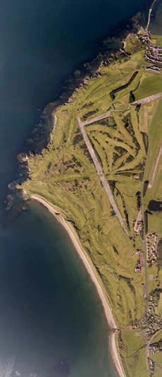
Turnberry golf courses mosaic
 Equipment
Our cameras include:
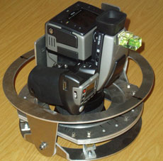
- Hasselblad H3D-39 (39 Mpixel)
- Kodak DCS Pro SLR/n (14 Mpixel)
- Canon 5D (12 Mpixel) modified to permit near-infrared photography,
all with calibrated lenses.
Hasselblad camera in vertical mount

Using our own Cessna 172 light aircraft fitted with a camera port to allow vertical photography, all parts of Scotland are within easy reach of our base at Inverness Airport, and we carry out sorties to other parts of the UK as required.
Cessna 172 fitted with camera port
 Digital Processing
Processing digital photographs for contrast correction etc. is extremely rapid. Subsequent orthorectification and mosaicing allows us to deliver a product ready for loading into a customer’s GIS system.
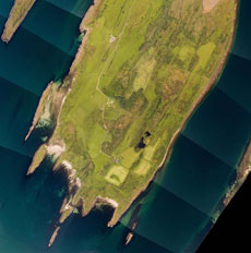
Danna Island mosaic for coastal monitoring
(© Scottish Natural Heritage)
 Specialist services
False colour infrared (CIR) imagery
False colour infrared imagery has uses in species identification, habitat and plant disease monitoring, and identification of pollution in watercourses, and other applications. With digital technology, false colour infrared imagery is no more difficult to acquire than standard colour photography.
False colour infrared photography - early spring

Stereo pair production
Automatic alignment of stereo pairs for viewing on screen with a variety of modern techniques can dramatically improve productivity in interpretation.
Stereo pair - River Feshie
Client list
- Air Images Ltd
- Balnagown Estate
- Ben Alder Estate
- Bluesky International Ltd
- CairnGorm Mountain Ltd
- Cairngorms National Park Authority
- Capita Lovejoy
- Cassie Woods Ltd
- CKD Galbraith
- Colas Ltd
- Denscot Evergreen Ltd
- Envirocentre Limited
- Forestry Commission Scotland
- Fountain Forestry Ltd
- Gledfield Estate
- Kirkby Estates Ltd
- Landmaps Ltd
- National Trust for Scotland
- Royal Society for the Protection of Birds
- Scottish Natural Heritage
- Scottish Native Woods
- Skibo Estate (The Carnegie Club)
- Strokesport Ltd
- Sylvestrus Ltd
- XYZ Digital Map Company Ltd
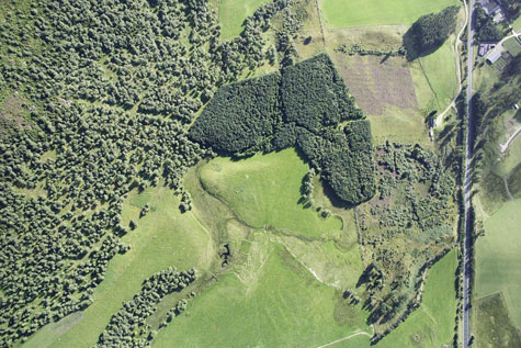
Near Kingussie survey photography for environmental monitoring